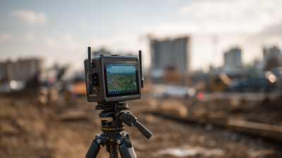
You know, in the fast-paced world of geospatial techthese days, Field Survey Equipment is really playing a bigger role than ever. I mean, according to the latestGlobal Geospatial Analytics Market report, this industry is actually expected to grow at a pretty solid rate of about 14.6% CAGR. That just shows how much everyone’s craving more advanced surveying gadgets and fresh mapping techniques. 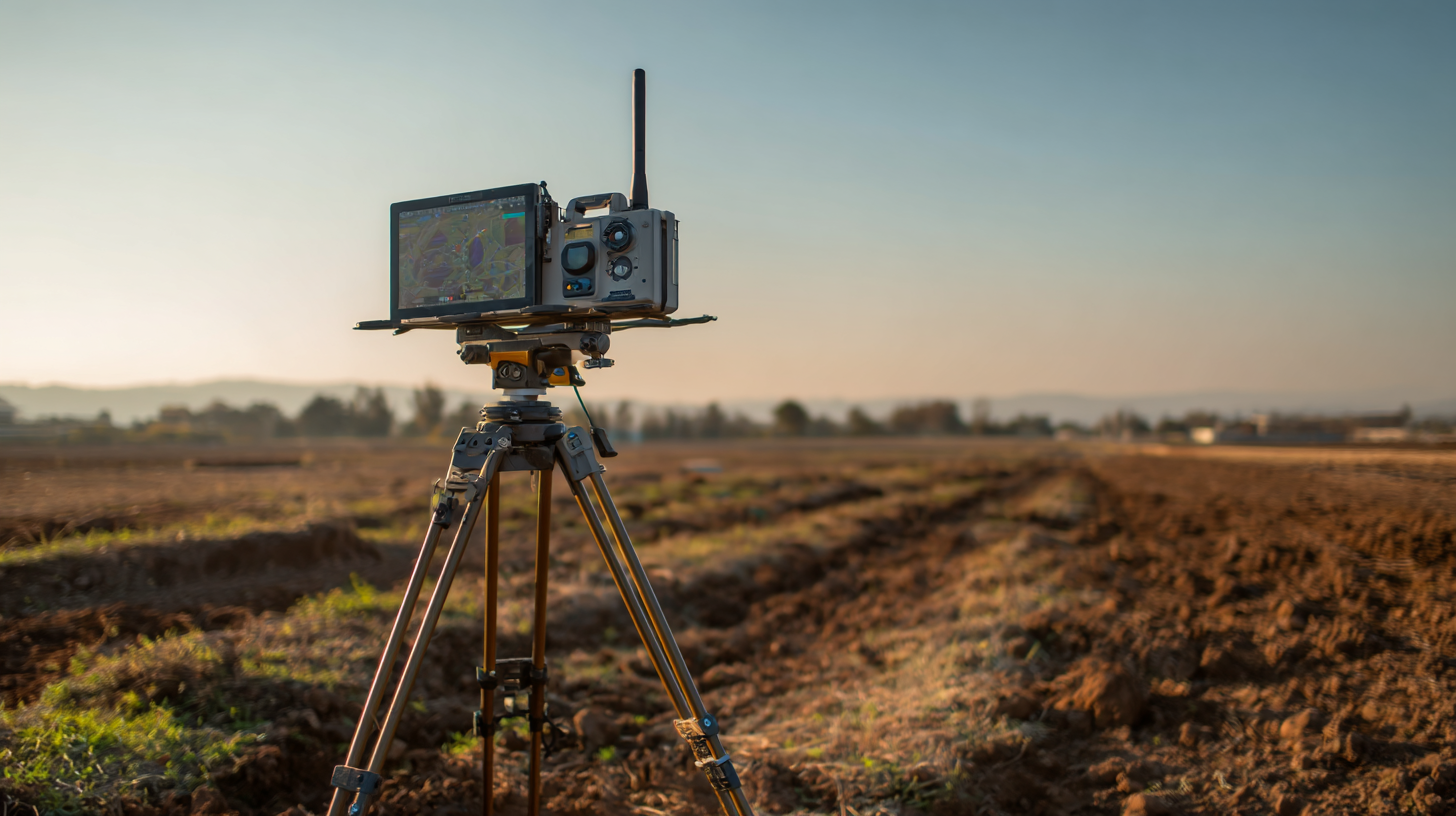 Companies like Shanghai Apekstool, or APEKS for short, are right at the cutting edge of all this change, offering awesome gear like GNSS/GPS units, total stations, and intuitive surveying software. These tools are not just improving the accuracy and speed of data collection—they’re also opening up new ways of mapping that are super crucial for all sorts of things, from city planning to protecting our environment. So, as we dive into some of the coolest uses of top-notch field survey gear, you'll see how these advances are really shaking things up, making geospatial data better and more reliable than ever.
Innovative Mapping Techniques: Harnessing China's Leading Survey Equipment
Nowadays, when it comes to modern mapping techniques, we're seeing a big push towards using really advanced field survey tools, especially in China — which is kinda leading the charge in this area. Just recently, data shows that high-res mapping tech like mobile differential absorption lidar is totally changing the game for how we keep tabs on things like atmospheric mercury emissions. These cool new tools give us real-time info, making it easier to do detailed environmental checks, which is super important for tackling ecological issues and planning infrastructure better.
On top of that, China's heavy investments in digital R&D are really paying off, giving rise to some pretty sophisticated mapping capabilities. For example, they're using satellite imagery to get a high-precision picture of rural wealth, helping to bridge the gap between policy decisions and what's actually happening on the ground. This kind of detailed info is a game-changer for the government's rural revitalization efforts. Apparently, mapping rural wealth isn't just a side project; it helps target exactly where help is needed and promotes sustainable growth, especially as cities keep expanding rapidly across China.
And let’s not forget, China is also making big moves in maritime exploration. They've been stepping up their efforts to map the oceans and monitor resources — clearly aiming to strengthen their presence at sea. Surveys of seabeds and potential zones show they’re really focusing on boosting their maritime strength. These mapping projects do more than just look cool; they give crucial insights into shipping routes and resource management, positioning China as a major player in future ocean-related geopolitics.
Innovative Uses of the Best Field Survey Equipment in Modern Mapping Techniques
| Equipment Type | Application | Accuracy | Key Features |
| Total Station | Construction surveying | ± 1 mm | High precision measurements, angle and distance measurement |
| GPS Surveying Equipment
| Geospatial analysis | ± 2-5 m | Real-time positioning, integrated mapping |
| LiDAR | Landscape modeling | ± 5 cm | High-resolution 3D mapping, vegetation analysis |
| Drones | Aerial surveys | ± 10 cm | Rapid deployment, high-resolution imagery |
| 3D Scanners | Historical documentation | ± 1 mm | Detailed surface capture, heritage site preservation |
Global Impact: The Export Reach of China's Top Field Survey Instruments
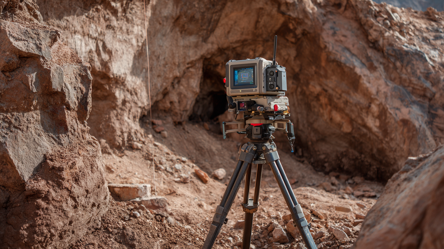
The surveying world has gone through some serious changes lately, mainly thanks to the latest and greatest field survey tools now available. Chinese manufacturers, especially companies like Shanghai Apekstool (or APEKS), are really leading the charge with their high-tech geospatial gear. These include GNSS/GPS systems, total stations, and other pretty innovative gadgets. Not only do these tools make mapping more accurate and efficient, but they’re also spreading their influence to markets all around the globe—really showing off China’s manufacturing skills.
What’s pretty exciting is how these top-tier Chinese survey instruments are expanding their reach worldwide, and that’s giving them a bigger say in the global mapping scene. Companies like APEKS aren’t just changing the game—they’re helping surveyors everywhere take on complicated mapping jobs with much more ease. And by customizing solutions to suit the unique needs of different regions, they’re actually playing a part in promoting sustainable development and better infrastructure planning across the board. All in all, these tech advancements are a big deal—they’re helping people make smarter decisions and manage resources better, shaping where the surveying industry is headed in the future.
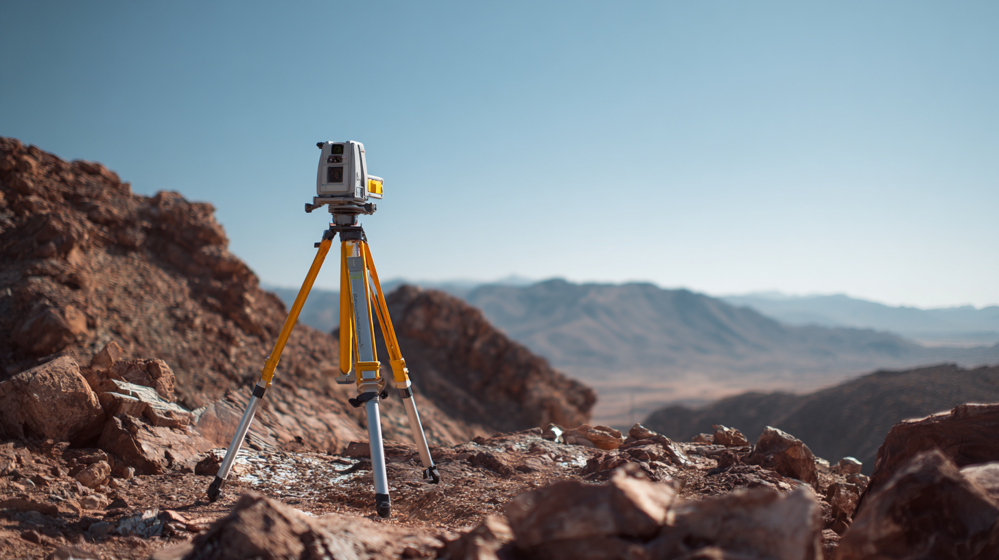
Precision in Mapping: The Role of Laser Scanning and UAVs in Modern Surveys
Lately, it’s pretty clear that laser scanning and drones—those small UAVs—have totally changed the game when it comes to modern mapping. They’re faster, way more precise, and just generally make life easier for everyone involved. I read somewhere that, according to MarketsandMarkets, the global market for UAVs in surveying is expected to hit around $6.9 billion by 2025, with a compound annual growth rate of roughly 14.7%. That’s pretty crazy growth! The main driver? The growing need for super accurate data in all sorts of fields—like farming, building new infrastructure, and keeping an eye on the environment. These drones, with their high-tech cameras, can snap sharp aerial photos and whip up detailed topographical maps way quicker than older, more manual methods.
At the same time, laser scanning—especially terrestrial laser scanning—adds an extra layer of detail. It’s like having a super precise 3D scan of whatever you're working on. A study from the Journal of Applied Remote Sensing points out that TLS can get down to an accuracy of about 5 millimeters—that’s really impressive. It’s perfect for projects that need really detailed work, like restoring old historical sites or checking out infrastructure. As demand for pinpoint accuracy keeps climbing, more and more folks are combining laser scans with drone tech—it's pretty much becoming the go-to method in civil engineering and land surveying. It’s all about giving professionals the tools they need to handle today’s tricky, modern landscapes—and do a quality job, every time.
Cost Efficiency and Accuracy: Comparing Traditional vs. Modern Survey Equipment
When it comes to modern mapping techniques, folks often debate whether to stick with traditional tools like theodolites and tape measures or to go for the newer gadgets. Honestly, traditional gear has been around forever and gets the job done, but in today’s fast-moving projects, it might not always give you the kind of precision you need. On the flip side, newer stuff like GPS units and drones can really speed things up and give you more accurate data—making your results way more reliable.
Pro tip: When you're picking out equipment for your project, it’s worth doing a good ol’ cost-benefit check. Don't just look at what you’re shelling out initially—think about ongoing maintenance costs and how much time and money modern tools could save you down the line.
Plus, integrating software with your new survey gear makes it a breeze to process data in real-time, so you can make decisions on the fly. Traditional methods often take longer to give results, which can slow down the whole workflow.
Another tip: Make sure your team gets proper training on new tech. It’s super important—knowing how to operate these tools properly not only boosts productivity but also helps you get the most out of your investment.
All in all, weighing your options carefully and investing in the right training can really make or break the success of your mapping projects.
Data Integration: How Advanced Technologies are Shaping Mapping Standards
When we look at modern mapping techniques these days, it’s pretty clear that incorporating advanced tech is now a must if we want better data accuracy and usability. The whole idea of FAIR data—making sure info is Findable, Accessible, Interoperable, and Reusable—really pushes the need for pulling together data from all sorts of sources. This opens up a ton of exciting opportunities across different fields. Recent research shows that sticking to these principles can help optimize how we manage resources and make smarter decisions, especially when it comes to GIS (geographic information systems). Combining things like drone-based aerial data collection with AI and machine learning makes mapping way more efficient and real-time, which is a game-changer especially for quick data analysis.
On top of that, the way supply chain management is evolving is also pretty interesting. Companies are using deep learning and machine learning techniques to improve how they select suppliers, boost production efficiency, and keep inventory under control. It really highlights how important integrated data systems are. Looking ahead, more organizations are combining multi-omics data and semantic tech to make everything more standardized and user-friendly. This is especially crucial for industries that rely heavily on precise mapping and analysis—think healthcare and logistics. Pushing for better data integration isn't just about making things smoother now; it also sets the stage for exciting new applications in clinical trials and helps establish solid mapping standards as AI and machine learning continue to grow in importance.
Sustainable Practices: The Environmental Benefits of Modern Field Survey Equipment
You know, innovative field survey tools are really making a big difference when it comes to pushing for more sustainable practices in modern mapping. As industries start leaning towards being more eco-friendly — especially with the rise of precision agriculture tech (PATs) — we're seeing a real push to incorporate greener survey methods. Recent studies show that precision agriculture not only boosts crop yields by around 15-20%, but it also cuts down on the environmental impact, helping us use resources smarter.
One of the coolest advancements lately is the use of drones in field surveying — honestly, they've totally changed the game for farming and land assessment. Drones let us get a clear look at crop health from above, which means farmers can make targeted interventions that are better for the environment. And with the drone market projected to hit over $40 billion by 2025, it’s pretty clear these tools aren’t just about efficiency—they’re also crucial for sustainable farming goals.
Here are some tips if you wanna get started with eco-friendly field surveying:
- Consider jumping into drone tech to get better at assessing land and managing resources.
- Use real-time data collection tools that don’t disturb the environment too much.
- Team up with green tech companies—they can help make your surveying gear even more sustainable.
By adopting these modern techniques, not only can we leave a smaller ecological footprint, but we also make our mapping efforts more precise and effective — winning all around.
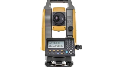
Maximize Surveying Precision with the Japan Brand Topcon GM52 Total Station: A Comprehensive Overview and User Guide
The Topcon GM52 Total Station is designed to elevate your surveying precision and efficiency, making it an indispensable tool for construction professionals and land surveyors alike. With integrated construction and survey application software, users can streamline their workflows and enhance productivity. The Bluetooth communication feature allows for seamless connectivity with other devices, enabling real-time data sharing and analysis right on the job site.
What sets the GM52 apart is its remarkable Electronic Distance Measurement (EDM) capabilities. With an accuracy of 1.5mm + 2.0ppm to prisms and 2mm + 2ppm in reflectorless mode, the GM52 ensures that you can trust the measurements you're collecting. Its ability to measure reflectorless up to 500m and a prism range of up to 4,000m gives surveyors unparalleled flexibility, whether working on small sites or expansive projects. Additionally, the advanced angle accuracy of 2" ensures that every calculation is precise, leading to improved final outcomes in all your surveying tasks.
The GM52 also features a dual keyboard in the 2" model, enhancing usability and allowing for easier data entry in various conditions. With an IP66 dust and waterproof rating, this total station is rugged enough to withstand tough environmental conditions, ensuring that your work can continue uninterrupted. The Topcon GM52 Total Station combines advanced technology and robust design, making it the go-to choice for professionals seeking to maximize surveying precision.
FAQS
: China's top field survey instruments, particularly from manufacturers like Shanghai Apekstool (APEKS), enhance accuracy and efficiency in mapping while extending their reach to international markets, showcasing China's manufacturing capabilities.
Modern survey tools like GPS devices and drones offer significantly improved data collection speed and accuracy compared to traditional tools, leading to more reliable outcomes and better project efficiency.
Innovative field survey equipment, such as drones, contributes to sustainable practices by improving crop production efficiency and reducing environmental impacts, thus aligning with eco-friendly initiatives.
A cost-benefit analysis helps assess not only the initial purchase price but also maintenance costs and potential labor savings, ensuring more informed decisions when choosing survey tools.
Tips include investing in drone technology for land assessment, using real-time data collection tools to minimize ecological disruption, and partnering with green technology firms to enhance sustainability.
Adequate training for teams in operating new technologies enhances productivity and helps maximize the benefits of modern equipment in mapping projects, ultimately improving project outcomes.